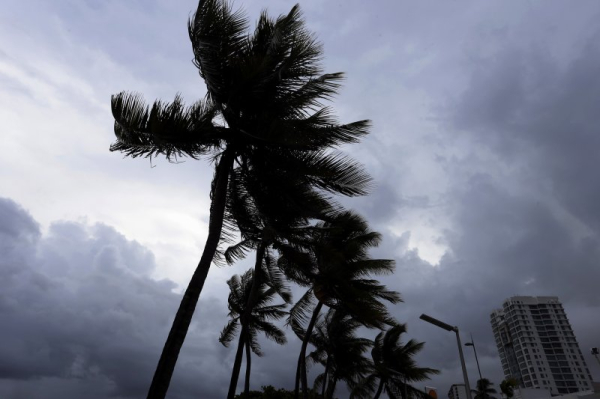
Tropical Storm Philippe’s track has shifted farther west, and the system could deliver storm effects to some islands of the Caribbean by this weekend, AccuWeather meteorologists say. If the system survives as a powerful storm, rough seas will reach the Leeward Islands at the end of the week, and Puerto Rico (pictured in the path of a tropical storm in 2017) could then see effects later this weekend. File Photo by Thais Llorca/EPA-EFE
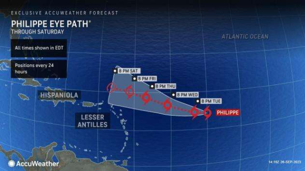
Changing conditions over the central Atlantic have caused Tropical Storm Philippe’s track to shift much farther to the west, and the system could bring some effects to the islands of the northern Caribbean by this weekend, AccuWeather meteorologists say.
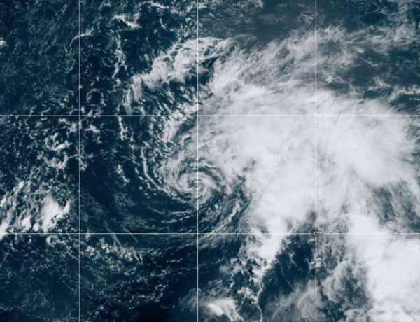
Hostile breezes, known as wind shear, have altered the structure of Philippe so that the upper part of the storm has been blown off to the northeast while the bottom part of the storm continues to move westward. Advertisement
The wind shear will keep Philippe’s strength in check, likely allowing it to remain below hurricane force. It’s even possible for Philippe to drop below tropical storm intensity at some point over the next several days.
For context, a hurricane has sustained winds of 74 mph or greater, while a tropical storm has sustained winds of 39-73 mph.
|
|
| This image of Tropical Storm Philippe was captured on Tuesday, Sept. 26, 2023. (NOAA Satellite) |
Advertisement
“With only the lower part of the storm remaining, it will be guided westward by the easterly trade winds,” AccuWeather Tropical Meteorologist Alex DaSilva said, adding that stronger south-to-southwest winds in the middle layer of the atmosphere won’t exert as much influence of the system’s movement.
“There is even a chance the system will totally break up as it moves westward,” DaSilva added.
|
|
If some organization remains and the system survives as a tropical storm, depression or tropical wind and rainstorm, there is a chance that fringe-effect showers and thunderstorms and rough seas will reach the Leeward Islands at the end of the week. Puerto Rico could then have impacts this weekend.
There are some indications that Philippe will survive and wander near the southeastern coast of the United States later next week due to the more westward shift in its track, AccuWeather Hurricane Expert Dan Kottlowski said during an interview on the AccuWeather Network.
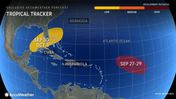
AccuWeather meteorologists are watching another disturbance, called a tropical wave, farther to the east over the Atlantic.
DaSilva explained that the disturbance has a high chance of tropical development late this week, adding that early signs point to this feature passing close by the Leeward Islands early next week, bringing the potential for rough surf and rain.
|
|
Advertisement
“Provided the system in the zone from the southeast Gulf to Florida does not form, or form first at least, this tropical wave over the central Atlantic could become the next named tropical system of the 2023 Atlantic season,” AccuWeather Chief On-Air Meteorologist Bernie Rayno said. The next two systems to develop will be named Rina and Sean.
The central Atlantic tropical wave may behave similarly and experience some of the same steering influences that caused Philippe’s track to pivot farther to the west.
Trade winds in the lower part of the atmosphere will guide the system westward. As the storm gets stronger and reaches higher into the atmosphere, stronger breezes at mid-levels associated with wind shear may either turn the system to the north or rip it apart and allow it to wander farther to the west, as Philippe did. If this occurs, it too may wander close enough to bring some impacts to the islands of the northeastern Caribbean next week.
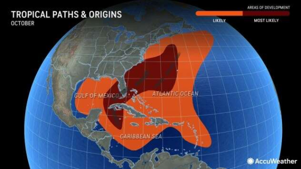
During October and November, wind shear typically increases over much of the Atlantic basin, suppressing some development and organization of tropical systems.
|
|
However, waters surrounding the U.S. can still birth tropical systems late in hurricane season. Advertisement
During an El Niño pattern, which is underway with warmer-than-normal waters in parts of the tropical Pacific, wind shear tends to develop more rapidly and with more strength over the Atlantic, hastening the inhibiting factors for tropical development across much of the basin.
