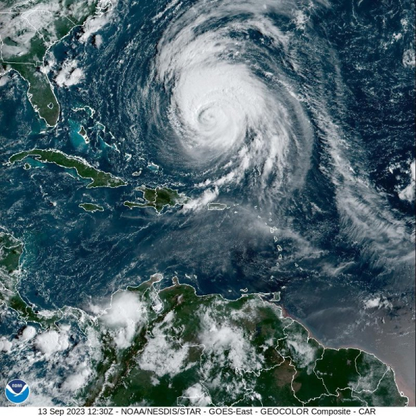
Hurricane Lee, a Category 3 storm, was forecast to pass by Bermuda and bring hazardous conditions to the Atlantic coast Wednesday. A Tropical Storm Warning was in effect for Bermuda. Image courtesy NOAA
Hurricane Lee remained a strong storm Wednesday morning, threatening hazardous conditions for beaches along the western Atlantic with risks of wind, coastal flooding and increasing rain impacts for parts of New England and Atlantic Canada, according to the national Hurricane Center.
In its 8 a.m. AST update, the NHC located Lee about 460 miles south-southwest of Bermuda. It was moving northwest at 6 mph and carrying maximum sustained winds of 115 mph. Advertisement
A tropical storm warning is in effect for Bermuda. Tropical storm conditions are expected in Bermuda beginning early Thursday.
Lee became a Category 3 storm on the Saffir-Simpson Hurricane Wind Scale on Monday morning. Slow weakening is forecast for the next few days, but Lee is likely to remain a very large and dangerous hurricane into the weekend, according to the National Hurricane Center.
The northeastern United States and Atlantic Canada were encouraged to monitor Lee’s progress with expectations that watches could be issued later Wednesday or Wednesday night.
Lee is expected to turn toward the north-northwest later Wednesday, then head north picking up speed Thursday and Friday. The center of Lee will move west of Bermuda Thursday and Thursday night, and will then approach the coasts of New England or Canada later this week. Advertisement
Forecasters warned about hazardous surf and rip currents at western Atlantic beaches throughout the week.
Lee was expected to generate swells that were likely to cause life-threatening surf and rip current conditions in portions of the Lesser Antilles, the British and U.S. Virgin Islands, Puerto Rico, Hispaniola, the Turks and Caicos Islands, the Bahamas and Bermuda.
Dangerous surf and rip currents are affecting parts of the southeastern U.S. coast. Those conditions are expected to spread northward along much of the U.S. East Coast and Atlantic Canada over the next couple of days.
Though its core is expected to pass west of Bermuda, the forecasters are warning that “the large wind field of the storm is likely to bring wind impacts to the island later this week, and tropical storm watches could be required later today.”
The NHC said Lee was expected to make a slow west-northwest to northwest move during the next day or so before turning north by midweek.